Miscellaneous Maps, Charts & Sections
-
Books & Reports
- Reports of Investigations
- Guidebooks
- Udden Series
- Geological Circulars
- Down To Earth
- Atlases of Major Oil and Gas Reservoirs
- Texas Memorial Museum Publications
- Environmental Geologic Atlas of the Texas Coastal Zone
- Mineral Resource Circulars
- Other Reports
- Seminars and Workshops
- Handbooks
- Submerged Lands of Texas
- Symposia
- Annual Reports
- Open File Reports
-
Maps & Cross Sections
- Thematic Maps
- Miscellaneous Maps, Charts & Sections
- Geologic Atlas of Texas
- STATEMAP Project Maps
- Geologic Quadrangle Maps
- Cross Sections
- Highway Geology Map
- Energy and Mineral Resource Maps
- Shoreline Change and Other Posters
- Wilcox Group, East Texas, Geological / Hydrological Folios
- Bouguer Gravity Atlas of Texas
- River Basin Regional Studies
- Featured Maps
- Posters
- Teachers & the Public
-
Geological Society Publications
- Gulf Coast Association of Geological Societies
- Alabama Geological Society
- Austin Geological Society
- Corpus Christi Geological Society
- Houston Geological Society
- Lafayette Geological Society
- Mississippi Geological Society
- New Orleans Geological Society
- South Texas Geological Society
- GCS SEPM Publications
- Historic BEG & UT Series


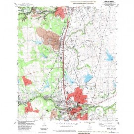
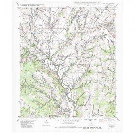
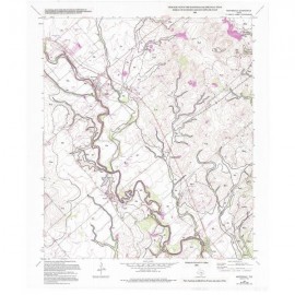
Southeast Part of the Austin, Texas, 30 x 60 Minute Quadrangle
MM0047
For a downloadable, digital version: MM0047D.
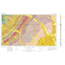
MM0047. Geologic Map of the Southeast Part of the Austin, Texas, 30 x 60 Minute Quadrangle: Central Texas Population Corridor Encompassing Bastrop and Smithville, by E. W. Collins. Oversize color map, scale 1:100,000, 2008.
To purchase this publication as a PDF download, please order MM0047D.
About This Publication
This geologic map of the southeastern Austin corridor in Central Texas was constructed by digital compilation of eight 1:24,000-scale open-file geologic maps. The map is intended to be used by professionals and laypeople as a source of general geologic information about land and resource use and management. Geology of the area consists mostly of Paleocene through Eocene mud- and sand-rich units. Minor Upper Cretaceous marine marl and calcareous mud deposits are in the western study area. Quaternary high-gravel deposits and well-defined terrace deposits of the Colorado River also occur. Bedrock units typically exhibit eastward regional dips of less than 2°. In the western and eastern parts of the study area, northeast-striking normal faults cut strata. Aquifer units include the Carrizo-Wilcox, Queen City, Sparta, and Yegua. Resources include sand, gravel, clay, lignite, and oil.
Keywords: maps, geologic maps, land use, mineral resources, aquifers, Austin area, Bastrop area, Smithville area, Central Texas, Texas
Citation
Collins, E. W., 2008, Geologic Map of the Southeast Part of the Austin, Texas, 30 x 60 Minute Quadrangle: Central Texas Population Corridor Encompassing Bastrop and Smithville: The University of Texas at Austin, Bureau of Economic Geology, Miscellaneous Map No. 47, scale 1:100,000.