Miscellaneous Maps, Charts & Sections
-
Books & Reports
- Reports of Investigations
- Guidebooks
- Udden Series
- Geological Circulars
- Down To Earth
- Atlases of Major Oil and Gas Reservoirs
- Texas Memorial Museum Publications
- Environmental Geologic Atlas of the Texas Coastal Zone
- Mineral Resource Circulars
- Other Reports
- Seminars and Workshops
- Handbooks
- Submerged Lands of Texas
- Symposia
- Annual Reports
- Open File Reports
-
Maps & Cross Sections
- Thematic Maps
- Miscellaneous Maps, Charts & Sections
- Geologic Atlas of Texas
- STATEMAP Project Maps
- Geologic Quadrangle Maps
- Cross Sections
- Highway Geology Map
- Energy and Mineral Resource Maps
- Shoreline Change and Other Posters
- Wilcox Group, East Texas, Geological / Hydrological Folios
- Bouguer Gravity Atlas of Texas
- River Basin Regional Studies
- Featured Maps
- Posters
- Teachers & the Public
-
Geological Society Publications
- Gulf Coast Association of Geological Societies
- Alabama Geological Society
- Austin Geological Society
- Corpus Christi Geological Society
- Houston Geological Society
- Lafayette Geological Society
- Mississippi Geological Society
- New Orleans Geological Society
- South Texas Geological Society
- GCS SEPM Publications
- Historic BEG & UT Series


Selected Texas County Maps, 1929-1937. Digital Download
MM0008D
Selected Texas County Maps, 1929-1937. Digital Version
MM0008D. Selected [Texas] County Maps, 1929-1937 - Downloadable PDF only
About This Publication
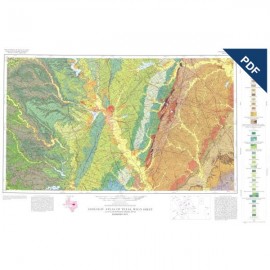
These are 21 Texas county maps made in cooperation with the American Association of Petroleum Geologists and Society of Economic Paleontologists and Mineralogists, issued between 1929 and 1932 and revised in 1937. They show surface geology with columnar sections; no structure or oil field data are included. Scale 1 inch equals 4,000 feet, except the map for Brown County, which was revised in 1951 to scale 1 inch equals 1 mile. Available only as a set of downloadable (D) PDF's.
Counties included are Baylor, Bell, Brown, Callahan, Coleman, Eastland, Fisher, Foard, Jack, Jones, King, Palo Pinto, Parker, Shackelford, Stephens, Stonewall, Taylor, Throckmorton, Wichita, Wise, and Young.
Keywords: maps, county maps, Baylor County, Bell County, Brown County, Callahan County, Coleman County, Eastland County, Fisher County, Foard County, Jack County, Jones County, King County, Palo Pinto County, Parker County, Shackelford County, Stephens County, Stonewall County, Taylor County, Throckmorton County, Wichita County, Wise County, Young County, Texas