Reports of Investigations
-
Books & Reports
- Reports of Investigations
- Guidebooks
- Udden Series
- Geological Circulars
- Down To Earth
- Atlases of Major Oil and Gas Reservoirs
- Texas Memorial Museum Publications
- Environmental Geologic Atlas of the Texas Coastal Zone
- Mineral Resource Circulars
- Other Reports
- Seminars and Workshops
- Handbooks
- Submerged Lands of Texas
- Symposia
- Annual Reports
- Open File Reports
-
Maps & Cross Sections
- Thematic Maps
- Miscellaneous Maps, Charts & Sections
- Geologic Atlas of Texas
- STATEMAP Project Maps
- Geologic Quadrangle Maps
- Cross Sections
- Highway Geology Map
- Energy and Mineral Resource Maps
- Shoreline Change and Other Posters
- Wilcox Group, East Texas, Geological / Hydrological Folios
- Bouguer Gravity Atlas of Texas
- River Basin Regional Studies
- Featured Maps
- Posters
- Teachers & the Public
-
Geological Society Publications
- Gulf Coast Association of Geological Societies
- Alabama Geological Society
- Austin Geological Society
- Corpus Christi Geological Society
- Houston Geological Society
- Lafayette Geological Society
- Mississippi Geological Society
- New Orleans Geological Society
- South Texas Geological Society
- GCS SEPM Publications
- Historic BEG & UT Series
Structure and Evolution of Upheaval Dome
RI0262
For a downloadable, digital version: RI0262D.
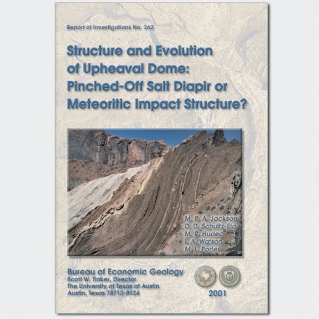
RI0262. Structure and Evolution of Upheaval Dome: Pinched-Off Salt Diapir or Meteoritic Impact Structure?, by M.P.A. Jackson, D. D. Schultz-Ela, M. R. Hudec, I. A. Watson, and M. L. Porter. 93 p., 42 figs., 1 table, 1 appendix, 2001. Print.
To purchase this publication as a downloadable PDF, please order RI0262D.
ABOUT THIS PUBLICATION
Upheaval Dome remains one of the most enigmatic structures in North America. Ongoing debate continues about whether the structure is a deeply eroded meteor-impact structure or a pinched-off salt dome. This report presents the case for the salt-dome hypothesis and critically evaluates the arguments on both sides of the debate.
ABSTRACT
Upheaval Dome (Canyonlands National Park, Utah, is an enigmatic structure previously attributed to underlying salt doming, cryptovolcanic explosion, fluid escape, or meteoritic impact. We instead propose that an overhanging diapir of partly extrusive salt was pinched off from its stem and subsequently eroded. Many features support this inference, especially synsedimentary structures that indicate Jurassic growth of the dome over at least 20 m.y. Conversely, evidence favoring other hypotheses is sparse and equivocal.
In the rim syncline, strata were thinned by circumferentially striking, low-angle extensional faults verging both inward (toward the center of the dome) and outward. Near the dome's core, radial shortening produced constrictional bulk strain, forming an inward-verging thrust duplex and tight to isoclinal, circumferentially trending folds. Farther inward, circumferential shortening predominated: radially trending growth folds and imbricate thrusts pass inward into steep clastic dikes in the dome's core.
We infer that abortive salt glaciers spread from a passive salt stock during the Late Triassic and Early Jurassic. Later, during the Middle Jurassic, the allochthonous salt spread into a pancake-shaped glacier inferred to be 3 km in diameter. Diapiric pinch-off may have involved inward gravitational collapse of the country rocks, which intensely constricted the center of the dome. Sediments in the axial shear zone beneath the glacier steepened to near vertical. The central uplift is inferred to be the toe of the convergent gravity-spreading system.
Keywords: extrusive salt, meteoritic impact, necked diapir, salt diapir, syndepositional deformation, Upheaval Dome, Utah, Paradox Basin
CONTENTS
ABSTRACT
INTRODUCTION
Hypotheses for Origin of Upheaval Dome
Tectonic Setting
Stratigraphic Setting
Field Mapping and Methodology
CIRCUMFERENTIAL FOLD SYSTEM
SYNSEDIMENTARY STRUCTURES
Syn-Chinle Deformation
Syn-Wingate Deformation
Wingate Internal Diastems
Wingate Growth Folds
Syn-Kayenta Deformation
Basal Kayenta Channels
Kayenta Internal Diastems and Inferred Shifting Rim Synclines
Kayenta Growth Faults
OUTER EXTENSIONAL SYSTEMS
INNER CONTRACTIONAL SYSTEMS
Kayenta Fold and Thrust Belt
Wingate Structures
Chinle Deformation in Central Depression
Central Moenkopi Constriction
Dome Center and Clastic Dikes
COMPARISON OF EVIDENCE FOR IMPACT VERSUS PINCH-OFF
Positive Evidence Compatible with Both Pinch-Off and Impact
Circularity
Central Uplift
Clastic Dikes
Crushed Quartz Grains
Inner Constrictional Zone
Outer Extensional Zone
Radial Lobes (Dog Tongues)
Underlying Salt
Gravity and Magnetic Anomalies
Contiguous Anticline
Nearby Salt Structures
Presence of Rim Syncline
Positive Evidence Compatible with Pinch-Off but not with Impact
Synsedimentary Structures
Volume Imbalance. Indicating Salt Loss and Primary Thickness Changes
Multiple Episodes of Fracturing and Cementation
Presence of Steep Zones in Inner Limb of Rim Syncline
Presence of Outward-Verging Extension
Presence of Rim Monocline
Positive Evidence Compatible with Impact but not with Pinch-Off
Shatter Cones
Salt below Rim Syncline
Negative Evidence Compatible with Impact and Pinch-Off
Absence of Rock Salt at the Surface
Paucity of Nearby Piercement Diapirs
Negative Evidence Compatible with Pinch-Off but not with Impact
Absence of Meteoritic Material
Absence of Melt
Paucity of Planar-Deformation Structures in Quartz
Absence of Ejecta Breccia
Absence of Shock-Metamorphic Minerals
Absence of In Situ Breccia
Absence of Outer Fault Terracing
Absence of Overturned Peripheral Flap
SUMMARY
SALT-TECTONIC HYPOTHESIS: A RECONSTRUCTION
Initiation of Diapirism
Stage 1: End Pennsylvanian
Stage 2: End Chinle
Stages 3and 4: End Wingate to End Kayenta
Stage 5: End Navajo
Salt Extrusion
Diapir Pinch-off
Stage 6: Present Day
CONCLUSIONS
ACKNOWLEDGMENTS
REFERENCES
APPENDIX 1. Volumetric Calculations
Figures
1. Location map of the northern Paradox Basin, showing Upheaval Dome, known salt structures, and Tertiary intrusions
2. Oblique air photograph, looking east up Upheaval Canyon
3. Panorama, looking generally southeast across the inner depression of Upheaval Dome
4. Oblique air photograph, looking approximately west across alcove D in Trail Canyon
5. Structure-contour map of Upheaval Dome and surroundings, showing the base of the Wingate Formation
6. Schematic illustrations of hypotheses supporting meteoritic impact and salt-dome pinch-off as explanations for the evolution of Upheaval Dome
7. Stratigraphic section near Upheaval Dome
8. Stratigraphy viewed from the rim monocline in an undeformed area immediately south of Upheaval Dome
9. Photograph illustrating our descent route down the Wingate Formation escarpment toward the inner depression
10. Geologic map of Upheaval Dome
11. Geologic maps of the central depression, showing stratigraphic units and faults and stratigraphic contacts, bedding attitudes, faults, fold axes, drainage network, and linear line of section B-B' shown in figure 13 and circular line of section C-C' shown in figure 14
12. Summary map of Upheaval Dome outer structures
13. Linear cross section of B-B' of Upheaval Dome and surroundings as inferred from surface exposures and projection from Buck Mesa well
14. Approximately circular cross section C-C' of the inner depression
15. Photograph illustrating view east from the valley that approximately follows the rim syncline on the southwest part of Upheaval Dome
16. Northwest-southeast cross section D-D' of Whale Rock, in the southeast part of dome, showing abrupt, anomalous steepening of Navajo dips on the inner limb of the withdrawal syncline
17. West-northeast cross section of panorama 9 traced from photographs of Holeman Spring alcove and adjoining exposures farther west on the south side of Upheaval Dome, photograph of similar view, and schematic reconstruction of synsedimentary deformation of Wingate Formation
18. Photograph illustrating northward view of radial growth folds in Lower Wingate sandstone in the northeast cliffs of the inner depression
19. Photograph illustrating southwestward view of a growth fault in cliff-forming Wingate Formation on the south wall of alcove A
20. Panoramas traced from photographs of outward-verging extensional-fault systems encircling Upheaval Dome
21. Photograph illustrating southwestward view across Upheaval Canyon, showing truncation surfaces of variable dip within the Kayenta Formation
22. East-west schematic restoration of intra-Kayenta geometries exposed in spurs south of Upheaval Canyon
23. Panoramas traced from photographs of inward-verging extensional-fault systems encircling Upheaval Dome
24. Oblique air photograph illustrating southwestward view of alcoves B and A
25. Panorama comprising three photographs along the east wall of the major valley adjacent to the syncline on the west to southwest side of Upheaval Dome
26. Closer view of left part of figure 25, interpreted as panorama 11 of figure 23
27. Photograph of outward-verging normal faults diagrammed in panorama 2 of figure 20
28. Photograph and west-east, wider, interpreted panorama 15 of a Kayenta thrust duplex and abrupt transition into the adjoining extensional system farther west
29. Geometry and inferred evolution of dog tongues
30. Views of dog tongues and intervening radial anticlines in southwest and west walls of inner depression
31. Photograph showing northward view of several circumferential. upright. tight to isoclinal folds in upper Wingate and lower Kayenta strata
32. Minor structures exposed in a folded thrust sheet in the southwest part of the inner depression
33. Photograph illustrating eastward view of radial thrusts stacking Moenkopi Formation in the western inner depression
34. Annotated photograph. looking north-northeast from the dome center at folds, imbricated thrust faults, and clastic dikes
35. Photograph, looking south at the center of Upheaval Dome
36. Branching of a clastic dike at its termination
37. Clastic dikes in the center of Upheaval Dome. showing both concordant and discordant relations with enclosing sedimentary layers
38. Clastic dike spires in the center of Upheaval Dome, looking northeast
39. Pinched-off diapir imaged by reflection seismic in the Gulf of Mexico
40. Microfractured quartz in White Rim clastic dikes from the core of Upheaval Dome
41. Air photograph of Dome 16 in the Great Kavir salt desert of Central Iran
42. Schematic reconstruction of the salt-tectonic evolution of Upheaval Dome
Table
1. Evidence supporting pinch-off and impact hypotheses
Citation
Jackson, M. P. A., Schultz-Ela, D. D., Hudec, M. R., Watson, I. A., and Porter, M. L., 2001, Structure and Evolution of Upheaval Dome: Pinched-Off Salt Diapir or Meteoritic Impact Structure?: The University of Texas at Austin, Bureau of Economic Geology, Report of Investigations No. 262, 93 p.


