Reports of Investigations
-
Books & Reports
- Reports of Investigations
- Guidebooks
- Udden Series
- Geological Circulars
- Down To Earth
- Atlases of Major Oil and Gas Reservoirs
- Texas Memorial Museum Publications
- Environmental Geologic Atlas of the Texas Coastal Zone
- Mineral Resource Circulars
- Other Reports
- Seminars and Workshops
- Handbooks
- Submerged Lands of Texas
- Symposia
- Annual Reports
- Open File Reports
-
Maps & Cross Sections
- Thematic Maps
- Miscellaneous Maps, Charts & Sections
- Geologic Atlas of Texas
- STATEMAP Project Maps
- Geologic Quadrangle Maps
- Cross Sections
- Highway Geology Map
- Energy and Mineral Resource Maps
- Shoreline Change and Other Posters
- Wilcox Group, East Texas, Geological / Hydrological Folios
- Bouguer Gravity Atlas of Texas
- River Basin Regional Studies
- Featured Maps
- Posters
- Teachers & the Public
-
Geological Society Publications
- Gulf Coast Association of Geological Societies
- Alabama Geological Society
- Austin Geological Society
- Corpus Christi Geological Society
- Houston Geological Society
- Lafayette Geological Society
- Mississippi Geological Society
- New Orleans Geological Society
- South Texas Geological Society
- GCS SEPM Publications
- Historic BEG & UT Series
Competing Effects of Depositional Architecture and Diagenesis on...Reservoir Development: Grayburg...South Cowden Field
RI0263
For a downloadable, digital version: RI0263D.
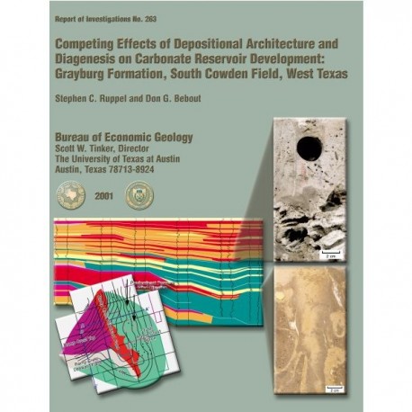
RI0263. Competing Effects of Depositional Architecture and Diagenesis on Carbonate Reservoir Development: Grayburg Formation, South Cowden Field, West Texas, by S. C. Ruppel and D. G. Bebout. 62 p., 49 figs., 1 appendix, 2001. Print.
To purchase this publication as a downloadable PDF, please order RI0263D.
About This Publication
In this study, 28 cores were used to define the depositional facies, cyclicity, and sequence stratigraphy of a typical upper Guadalupian carbonate platform reservoir in the Permian Basin. Integration of facies and petrophysical data, however, demonstrates that reservoir quality is largely a function of late diagenetic overprinting of depositional facies attributes by dolomite diagenesis and anhydrite alteration and removal.
ABSTRACT
As in most carbonate successions, reservoir development in the Grayburg Formation (Guadalupian, Permian) in South Cowden field is the result of a complex interplay between depositional and diagenetic processes. Although some diagenesis follows depositional architecture, much of the postdepositional alteration of these shallow- water carbonates crosscuts facies, resulting in a hybrid of depositionally and diagenetically controlled rock fabrics and flow units.
Core and wireline log study shows that the Grayburg at South Cowden field is the result of deposition at three scales of cyclicity. The Grayburg constitutes part of a single long-duration accommodation cycle that began with a major sea-level rise and flooding of the preexisting San Andres platform and ended with a major basinward shift in facies and deposition of overlying Queen Formation tidal-flat successions.
Within the Grayburg part of this long-duration cycle, four higher frequency sea-level- rise events, termed high-frequency sequences (HFS), can be recognized. Each of these is characterized by extensive flooding of the platform by outer ramp fusulinid-rich facies and subsequent highstand aggradation of grain-dominated peloidal facies. Platform flooding at the base of HFS 3 documents a regional sea-level maximum flooding event that is correlatable throughout the Permian Basin in both outcrop and the subsurface.
High-frequency cyclicity is variably expressed in the Grayburg, reflecting variations in platform accommodation and delivery of siliciclastics. In transgressive lower Grayburg sequences (HFS 1, HFS 2), cyclicity is poorly displayed because of lack of internal organization in outer ramp fusulinid-dominated succession and facies amalgamation in high-energy windward ramp-crest successions. Highstand sequences (HFS 3, HFS 4), on the other hand, display well-developed, highly correlative, high-frequency cycles because of low platform relief and sufficient facies contrast between base-of-cycle mud-dominated facies and cycle-capping peloid/ooid grain-dominated deposits of the leeward ramp crest.
Although the entire formation has been altered by multiple episodes of diagenesis, two major diagenetic events have exhibited strong local controls on reservoir character: dolomitization and sulfate alteration and removal. Tan, isotopically depleted dolomite is locally common along vertical burrows in highly cyclic mud-dominated packstones and wackestones of the HFS 4 Grayburg highstand succession. Later alteration and removal of anhydrite is focused in structurally low sections along the eastern and southern (downdip) margins of the field. Where these diagenetic zones overlap, original depositional heterogeneities are muted.
Tan dolomite exhibits an average of twice the porosity and an order of magnitude greater permeability than adjacent gray-brown rocks because of rock-fabric differences. Especially where sulfate removal has occurred, tan zones contain intercrystalline and touching-vug pores in contrast to separate-vug pores characteristic of unaltered zones. These rock-fabric types display distinctly different porosity-permeability relationships.
Highest permeabilities and continuity are developed along the margins of the field where sulfate diagenesis has created an extensive system of touching vugs and interconnected pores. In this part of the field, depositional framework has a limited impact on reservoir architecture and flow. By contrast, the interior of the field is characterized by intercrystalline and separate-vug pores whose distribution is strongly controlled by depositional facies framework.
Keywords: carbonate reservoir, diagenesis, Grayburg Formation, Permian, sequence stratigraphy
CONTENTS
ABSTRACT
INTRODUCTION
METHODS
SETTING
PREVIOUS WORK
STRUCTURAL CONTROLS ON RESERVOIR DEVELOPMENT
GRAYBURG DEPOSITIONAL FACIES IN SOUTH COWDEN FIELD
Fusulinid Wackestone and Packstone
Grain-Dominated Packstone-Grainstone
Peloid Wackestone/Packstone
Skeletal Wackestone/Packstone
Tidal-Flat Facies
Siltstone/Sandstone
Other Minor Facies
GRAYBURG CYCLE ARCHITECTURE
Grayburg High-Frequency Sequences
Grayburg HFS 1
Grayburg HFS 2
Grayburg HFS 3
Grayburg HFS 4
Discussion
RESERVOIR FRAMEWORK: SOUTH COWDEN FIELD
GENERAL POROSITY TRENDS
DIAGENESIS
Dolomitization
Alteration and Leaching of Anhydrite
IMPACT OF DIAGENESIS ON RESERVOIR QUALITY
EFFECTS OF STRATAL ARCHITECTURE VERSUS DIAGENESIS ON RESERVOIR DEVELOPMENT
CONCLUSIONS
ACKNOWLEDGMENTS
REFERENCES
APPENDIX A. Stable isotope data: Grayburg Formation, South Cowden field
Figures
1. General correlations and stratigraphic nomenclature of upper Leonardian and Guadalupian (middle Permian) strata in the Permian Basin, West Texas and New Mexico
2. Map showing the Guadalupian paleogeography of West Texas and New Mexico and the distribution of major shallow-water platform Permian carbonate reservoirs, including those productive from the Grayburg Formation
3. Map of South Cowden field showing the structure on the top of the Grayburg Formation and area of study
4. Map of eastern Ector County showing the distribution of major structural and depositional features in late Leonardian to Guadalupian time
5. Southwest-northeast wireline log cross section A-A' from Penwell field to South Cowden fieldshowing general facies patterns, interfield correlations, and the position of the lower Guadalupian progradational wedge (probable Brushy Canyon equivalent) below the South Cowden field
6. Southeast-trending cross section B-B' from 3-D seismic data in South Cowden field showing terminal Glorieta/Clear Fork platform margin and overlying progradational wedge
7. Seismic time-structure map showing the topography of the top of the Glorieta/Clear Fork platform
8. Seismic time-structure map showing the topography of the top of the Grayburg Formation in the South Cowden field
9. Sequence stratigraphic relationships in the upper Leonardian-lower Guadalupian section in the Guadalupe Mountains
10. Map of the Guadalupe Mountains, Texas and New Mexico, showing location of major upper Leonardian and lower Guadalupian outcrop localities
11. Sequence-based stratigraphic nomenclature of the upper Leonardian and lower Guadalupian section in the Permian Basin
12. Generalized depositional model for middle Permian shallow-water carbonate platform succession in the Permian Basin
13. Cross section C-C' showing Grayburg sequence stratigraphic framework in the South Cowden field
14. Distribution of paleoenvironmentally significant Grayburg facies along cross section C-C' at South Cowden field
15. Photographs of major Grayburg Formation subtidal facies in the South Cowden field area
16. Styles of cyclicity in outer ramp. fusulinid-dominated facies
17. Core photograph of vertically burrowed, peloid/skeletal wackestone
18. Core photograph of tidal-flat facies in the Grayburg Formation at South Cowden field
19. Core photograph of siltstone-sandstone facies typical of the uppermost Grayburg and Queen Formations, South Cowden field
20. Typical vertical facies succession in the Grayburg and Queen Formations in the western part of the South Cowden Grayburg field
21. Vertical facies succession in Grayburg HFS 1 in the western, updip part of the South Cowden Grayburg field
22. General paleotopography at the end of Grayburg HFS 1 in the South Cowden field area
23. Thickness of grain-dominated packstone and grainstone in the highstand leg of Grayburg HFS 2
24. Cross section D-D' showing styles of cyclicity in grain-dominated packstone-grainstone cycles on the outer margin of the ramp crest
25. Thickness trends in the basal cycle of Grayburg HFS 3
26. Thickness of fusulinid facies in HFS 2
27. Paleogeography of the South Cowden field area at the end of HFS 2
28. Thickness of fusulinid facies in HFS 3
29. Cross section G-G' through the Moss Unit at South Cowden field showing onlap of basal Grayburg HFS 3 on ramp crest of HFS 2
30. Thickness of the lower half of Grayburg HFS 4 in South Cowden field
31. Thickness of the upper half of Grayburg HFS 4 in South Cowden field
32. Cross section H-H' showing high-frequency cyclicity in Grayburg highstand deposits
33. Paleogeography of HFS 4
34. Subdivision of Grayburg Formation reservoir units based on cycle stratigraphy
35. Phi*h map of Grayburg HFS 3-4, the primary productive section at South Cowden field
36. Phi*h map of Grayburg HFS 3
37. Phi*h map of the lower part of Grayburg HFS 4
38. Phi*h map of the upper part of Grayburg HFS 4
39. Crossplot of carbon and oxygen stable isotope data comparing tan and gray-brown dolomite on vertically burrowed wackestones
40. Comparison of porosity and permeability from tan and gray dolomite from vertically burrowed wackestones
41. Distribution of zones of tan dolomite and evidence of sulfate alteration and removal in the Unocal Moss Unit No. 6-20 well
42. Cross section C-C' through the Moss Unit showing the stratigraphic distribution of zones of tan dolomite
43. Map of South Cowden field showing the distribution of intervals of tan dolomite
44. Map of the distribution of altered sulfate and intervals of complete sulfate removal in the South Cowden field
45. Dip cross section C-C' through the Moss Unit showing the distribution of altered sulfate and intervals of complete sulfate removal
46. Photomicrographs showing porosity development associated with sulfate removal
47. West-east cross section I-I' through part of the Emmons Unit showing the distribution of altered sulfate and intervals of complete sulfate removal
48. Plot of core analysis porosity and permeability showing impact of dolomitization style on Grayburg Formation petrophysics
49. Plot of core analysis porosity and permeability showing impact of sulfate removal on Grayburg Formation petrophysics
Citation
Ruppel, S. C., and Bebout, D. G., 2001, Competing Effects of Depositional Architecture and Diagenesis on Carbonate Reservoir Development: Grayburg Formation, South Cowden Field, West Texas: The University of Texas at Austin, Bureau of Economic Geology, Report of Investigations No. 263, 62 p.
