Reports of Investigations
-
Books & Reports
- Reports of Investigations
- Guidebooks
- Udden Series
- Geological Circulars
- Down To Earth
- Atlases of Major Oil and Gas Reservoirs
- Texas Memorial Museum Publications
- Environmental Geologic Atlas of the Texas Coastal Zone
- Mineral Resource Circulars
- Other Reports
- Seminars and Workshops
- Handbooks
- Submerged Lands of Texas
- Symposia
- Annual Reports
- Open File Reports
-
Maps & Cross Sections
- Thematic Maps
- Miscellaneous Maps, Charts & Sections
- Geologic Atlas of Texas
- STATEMAP Project Maps
- Geologic Quadrangle Maps
- Cross Sections
- Highway Geology Map
- Energy and Mineral Resource Maps
- Shoreline Change and Other Posters
- Wilcox Group, East Texas, Geological / Hydrological Folios
- Bouguer Gravity Atlas of Texas
- River Basin Regional Studies
- Featured Maps
- Posters
- Teachers & the Public
-
Geological Society Publications
- Gulf Coast Association of Geological Societies
- Alabama Geological Society
- Austin Geological Society
- Corpus Christi Geological Society
- Houston Geological Society
- Lafayette Geological Society
- Mississippi Geological Society
- New Orleans Geological Society
- South Texas Geological Society
- GCS SEPM Publications
- Historic BEG & UT Series
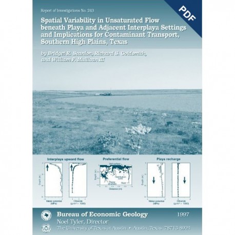
Spatial Variability in Unsaturatated Flow...Southern High Plains, Texas. Digital Download
RI0243D
For a print version: RI0243.
RI0243D. Spatial Variability in Unsaturated Flow Beneath Playa and Adjacent Interplaya Settings and Implications for Contaminant Transport, Southern High Plains, Texas, by B. R. Scanlon, R. S. Goldsmith, and W. F. Mullican III. 68 p., 27 figs., 7 tables, 5 appendices, 1997. doi.org/10.23867/RI0243D. Downloadable PDF.
To purchase this publication in book format, please order RI0243.
ABSTRACT
Analysis of spatial variability in unsaturated flow is critical to evaluating contaminant transport in areas of focused or preferential flow. This study examined spatial variability at a variety of scales from focused flow through playas to preferential flow in macropores. A total of 39 boreholes from 7 playa and adjacent interplaya settings on the Southern High Plains of Texas were sampled for hydraulic and hydrochemical parameters. To evaluate preferential flow in surficial sediments, we applied bromide and organic dyes.
Results of this study show that recharge is focused beneath playas, as evidenced by high water contents, high water potentials, low chloride and high tritium concentrations in pore water, and low carbonate contents in sediment. Water fluxes estimated from chloride and tritium data ranged from 60 to 120 mm yr-1l. In addition to focused recharge beneath playas, applied tracer experiments showed preferential flow of bromide and FD&C blue dye along roots and desiccation cracks through structured clays in playas. A multipeaked tritium profile to 29-m depth also indicated preferential flow. Frequent ponding in playas and the structured nature of the clay sediments predispose this system to preferential flow. In contrast to playas, unsaturated water flux in natural interplaya settings under current climatic conditions is negligible, as indicated by low water contents, low minimum water potentials, upward water potential gradients, high peak chloride concentrations in pore water, and high carbonate contents in sediment. Upward water potential gradients suggest net upward water movement in the top 5 to 10 m of the sediment. Chloride profiles suggest very low water fluxes (10.1 mm yr-1) during the past 2,000 to 5,000 yr. Spatial focusing of recharge beneath playas and preferential flow through macropores greatly increase the transport rate of contaminants through the unsaturated zone.
Keywords: focused recharge, playas, preferential flow, Southern High Plains, Texas, unsaturated zone
CONTENTS
Abstract
Introduction
Previous Work
Objectives
Hydrodynamics
Environmental and Applied Tracers
Site Description
Methods
Laboratory Methods
Sediment Texture and Water Content
Water Potential
Hydraulic Conductivity
Environmental Tracers
Meteoric Chloride
Chlorine-36
Tritium
Field Methods
Water Potential
Electromagnetic Induction
Ponding Tests
Results
Sediment Texture
Water Content
Water Potential
Temperature
Electromagnetic Induction
Environmental Tracers
Meteoric Chloride
Tritium
Applied Tracers
Discussion
Large-Scale Spatial Variability in Unsaturated Flow
Evidence of Spatial Variability Based on Saturated Zone Studies
Preferential Flow
Preferential Flow of Volatile Organics
Temporal Variability in Unsaturated Water Flux
Controls on Unsaturated Flow: Implications for Contaminant Transport
Conclusions
Acknowledgments
References
Appendices
A. Percent sand. silt. and clay; sediment texture classification; gravimetric water content; and carbonate content of sediment in sampled boreholes
B. Water and chloride content of sampled boreholes
C. Water potential measured by the Decagon SC-1OA thermocouple psychrometer and calculated osmotic potential
D. Apparent electrical conductivity measured by the EM3 1 meter along transects in TDCJ and Wink playa basins
E. Estimated diffusive chloride fluxes, advective chloride or water fluxes. and residence time of chloride
Figures
1. Conceptual diagram of water flow directions based on analysis of potential data from basic principles
2. Location of the study area that includes the seven sampled playas
3. Annual precipitation at Amarillo airport and daily precipitation at Amarillo airport and at Pantex
4. Location of sampled boreholes in Finley playa basin
5. Location of sampled boreholes in Koesjan playa basin
6. Location of sampled boreholes and unsaturated zone monitoring equipment in Playa 5 basin
7. Location of sampled boreholes in Sevenrnile Basin playa basin
8. Location of sampled boreholes, trenches, and EM transect in TDCJ playa basin
9. Location of sampled boreholes in Vance playa basin
10. Location of sampled boreholes and EM transect in Wink playa basin
11. Profiles of gravimetric water content, water potential, chloride, and texture for boreholes BEGPTX 1 and BEGPTX 2 at the Pantex Plant
12. Profiles of gravimetric water content. water potential. chloride, and texture for boreholes in Finley playa basin
13. Profiles of gravimetric water content. water potential. chloride, and texture for boreholes in Koesjan playa basin
14. Profiles of gravimetric water content. water potential. chloride, and texture for boreholes in Playa 5 playa basin
15. Profiles of gravimetric water content. water potential. chloride, and texture for boreholes in Sevenmile Basin playa basin
16. Profiles of gravimetric water content. water potential. chloride, and texture for boreholes in TDCJ playa basin
17. Profiles of gravimetric water content. water potential. chloride, and texture for boreholes in Vance playa basin
18. Profiles of gravimetric water content. water potential. chloride, and texture for boreholes in Wink playa basin
19. Comparisons of water potential measured by a thermocouple psychrometer in a Decagon SC-10 sample chamber and CX-2 water activity meter in soil samples from TDCJ 28, Vance 2, and Wink 1 boreholes
20. Variations with depth and time of water potential and temperature monitored daily by in situ thermocouple psychrometers in an interplaya setting in Playa 5 basin
21. Vertical distribution of water potential measured by in situ thermocouple psychrometers at Playa 5 and by the Decagon psychrometer in the laboratory on samples collected from interplaya settings
22. Vertical distribution of temperature measured by in situ thermocouple psychrometers in an interplaya setting in Playa 5 basin
23. Profiles of apparent electrical conductivity measured by an EM3 1 ground conductivity meter along transects in TDCJ and Wink playa basins
24. Variation in water flux with depth estimated from Playa 5 No. 26, TDCJ 1, and Wink 1 chloride profiles
25. Decay-corrected 3H measured in precipitation at Waco, Texas, and vertical profile of 3H gravimetric water content, and sand content in soil samples collected from Wink 14
26. Profile of blue dye under pond 1 infiltration test in TDCJ playa basin
27. Profiles of bromide concentration in soil samples collected under pond 1, pond 4, and pond 5 in TDCJ playa basin
Tables
1. Published recharge values, Southern High Plains
2. Characteristics of playas examined during this study
3. Summary of boreholes drilled, samples collected, and monitoring equipment installed
4. Ponding tests conducted in TDCJ playa basin
5. Geomorphic location of selected boreholes; mean percentage values of sand, silt, and clay; carbonate content; range and mean water content; minimum water potential; and mean and maximum chloride concentration
6. Matric potentials measured by pressure transducer tensiometers in core samples from Playa 5 No. 7
7. Tritium measurements in soil water samples collected from borehole Wink 14
Citation
Scanlon, B.R., Goldsmith, R. S., and Mullican, W. F. III, 1997, Spatial Variability in Unsaturated Flow Beneath Playa and Adjacent Interplaya Settings and Implications for Contaminant Transport, Southern High Plains, Texas: The University of Texas at Austin, Bureau of Economic Geology, Report of Investigations No. 243, 68 p. doi.org/10.23867/RI0243D.
