Reports of Investigations
-
Books & Reports
- Reports of Investigations
- Guidebooks
- Udden Series
- Geological Circulars
- Down To Earth
- Atlases of Major Oil and Gas Reservoirs
- Texas Memorial Museum Publications
- Environmental Geologic Atlas of the Texas Coastal Zone
- Mineral Resource Circulars
- Other Reports
- Seminars and Workshops
- Handbooks
- Submerged Lands of Texas
- Symposia
- Annual Reports
- Open File Reports
-
Maps & Cross Sections
- Thematic Maps
- Miscellaneous Maps, Charts & Sections
- Geologic Atlas of Texas
- STATEMAP Project Maps
- Geologic Quadrangle Maps
- Cross Sections
- Highway Geology Map
- Energy and Mineral Resource Maps
- Shoreline Change and Other Posters
- Wilcox Group, East Texas, Geological / Hydrological Folios
- Bouguer Gravity Atlas of Texas
- River Basin Regional Studies
- Featured Maps
- Posters
- Teachers & the Public
-
Geological Society Publications
- Gulf Coast Association of Geological Societies
- Alabama Geological Society
- Austin Geological Society
- Corpus Christi Geological Society
- Houston Geological Society
- Lafayette Geological Society
- Mississippi Geological Society
- New Orleans Geological Society
- South Texas Geological Society
- GCS SEPM Publications
- Historic BEG & UT Series
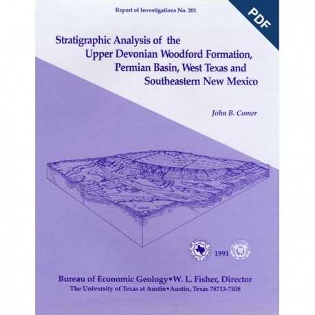
Stratigraphic Analysis of the.. Woodford Formation, Permian Basin, West Texas and SE New Mexico. Digital Download
RI0201D
For a print version: RI0201.
RI0201D. Stratigraphic Analysis of the Upper Devonian Woodford Formation, Permian Basin, West Texas and Southeastern New Mexico, by J. B. Comer. 63 p., 12 figs., 4 appendices, 7 pls., 1991. doi.org/10.23867/RI0201D. Downloadable PDF.
To order this publication in book format, please order RI0201.
ABSTRACT
The Upper Devonian Woodford Formation is an organic-rich petroleum source rock that extends throughout West Texas and southeastern New Mexico and currently is generating oil or gas in the subsurface. The Woodford is a potential hydrocarbon reservoir in areas where it is highly fractured; the most favorable drilling targets are fractured siltstone or chert beds in densely faulted regions such as the Central Basin Platform, southernmost Midland Basin, and parts of the Northwestern Shelf. Stratigraphic analysis was undertaken to determine how the Woodford was deposited and why its petroleum source potential is so great.
The Woodford consists of two lithofacies, black shale and siltstone. Black shale, the most widely distributed rock type, is very radioactive and contains varvelike parallel laminae, abundant pyrite, and high concentrations of marine organic matter. Siltstone, typically a basal facies, in deep basin and proximal shelf settings, exhibits disrupted stratification, graded layers, fine-grained Bouma sequences, and a subequal mixture of silt-sized quartz and dolomite. Black shale is mostly pelagic and represents an anaerobic biofacies, whereas siltstone is the result of bottom-flow deposition and represents a dysaerobic biofacies.
The depositional model developed herein for the Woodford was based on stratigraphic sequence, patterns of onlap, and lithologic variations, together with published information about global paleogeography, paleoclimate, and eustasy. During the Late Devonian, the Permian Basin was a low-relief region located on the western margin of North America in the arid tropics near 15 degrees south latitude. Worldwide marine transgression caused flooding of the craton and carried water from a zone of coastal upwelling into the expanding epeiric sea. Strong density stratification developed, due partly to accumulation of hypersaline bottom water that formed locally in the arid climate. Anaerobic conditions resulted from poor vertical circulation and from high oxygen demand, which was caused by the decay of abundant organic matter produced in the nutrient-rich surface waters. Continuous, slow deposition of pelagic material was interrupted by episodic, rapid deposition of silt and mud from bottom flows generated during frequent tropical storms.
This report documents the composition, distribution, and structure of the Woodford Formation in a major hydrocarbon-producing basin. Petrologic and organic geochemical data helped explain the origin of the unit and provided information necessary for predicting potential locations and lithologies of commercial petroleum reservoirs within the Woodford. Combining comprehensive stratigraphic, petrologic, and geochemical data was useful for developing a depositional and exploration model of Devonian black shale in West Texas and New Mexico. Similar studies should be conducted elsewhere to enable discovery of unconventional hydrocarbon reserves in black shales.
Keywords: Upper Devonian, Woodford, black shale, siltstone, source rocks, unconventional reservoirs, depositional model, paleogeography, Texas, New Mexico
CONTENTS
Abstract
Introduction
Methods
Stratigraphy
Nomenclature Age and Correlation
Previous Work Western Outcrop Belt Central Texas
Northeastern Oklahoma and Northern Arkansas
Ouachita Fold Belt
Central and Southern Oklahoma
Permian Basin
Formation Boundaries
Distribution
Northwestern Shelf and Matador Uplift
Eastern Shelf
Central Basin Platform and Pecos Arch
Delaware Basin
Midland Basin
Val Verde Basin
Diablo Platform and Western Outcrop Belt
Lithofacies12
Black Shale
Characteristic Features
Bedding and Sedimentary Structures
Texture
Composition
Siltstone
Characteristic Features
Bedding and Sedimentary Structures
Texture
Composition
Formation-Boundary Lithologies
Lower Contact
Upper Contact
Lithofacies Correlation
Lithofacies Distribution
Depositional Processes
Siltstone Black Shale Lithologic Patterns and Origin of Sediments
Depositional Setting
Paleogeography
Paleotectonics
Paleoclimate
Paleoceanography
Depositional Mechanisms
Synopsis of Depositional History
Petroleum Potential
Summary
Acknowledgments
References
Appendices
A. Location of cores and measured sections
B. Description of cores and measured sections
C. Point-count data for the Woodford Formation
D. Organic content of the Woodford Formation
Figures
1. Index maps showing structural provinces in the Permian Basin
2. Map showing lines of cross sections and locations of cores and measured sections
3. Correlation chart for Devonian and Mississippian Systems in West Texas and southeastern New Mexico
4. Photos of Woodford black shale
5. Photos of Woodford siltstone
6. Photos of Woodford contacts
7. Log correlation of Woodford lithofacies
8. Fence diagram of Upper Devonian units
9. Regional lithologic variations in Upper Devonian rocks in West Texas and southeastern New Mexico
10. Late Devonian paleogeography of West Texas and southeastern New Mexico
11. Late Devonian paleogeography of North America
12. Model of Late Devonian circulation during eustatic highstand
Plates (in back pocket of book)
1. Structure map of Woodford Formation, Permian Basin.
2. Isopach map of Woodford Formation, Permian Basin.
3. West-east cross section A-A'. Line of section in figure 2.
4. West-east cross section B-B'. Line of section in figure 2.
5. West-east cross section C-C'. Line of section in figure 2.
6. North-south cross section D-D'. Line of section in figure 2.
7. North-south cross section E-E'. Line of section in figure 2.
Citation
Comer, J. B., 1991, Stratigraphic Analysis of the Upper Devonian Woodford Formation, Permian Basin, West Texas and Southeastern New Mexico: The University of Texas at Austin, Bureau of Economic Geology, Report of Investigations No. 201, 63 p.
