Reports of Investigations
-
Books & Reports
- Reports of Investigations
- Guidebooks
- Udden Series
- Geological Circulars
- Down To Earth
- Atlases of Major Oil and Gas Reservoirs
- Texas Memorial Museum Publications
- Environmental Geologic Atlas of the Texas Coastal Zone
- Mineral Resource Circulars
- Other Reports
- Seminars and Workshops
- Handbooks
- Submerged Lands of Texas
- Symposia
- Annual Reports
- Open File Reports
-
Maps & Cross Sections
- Thematic Maps
- Miscellaneous Maps, Charts & Sections
- Geologic Atlas of Texas
- STATEMAP Project Maps
- Geologic Quadrangle Maps
- Cross Sections
- Highway Geology Map
- Energy and Mineral Resource Maps
- Shoreline Change and Other Posters
- Wilcox Group, East Texas, Geological / Hydrological Folios
- Bouguer Gravity Atlas of Texas
- River Basin Regional Studies
- Featured Maps
- Posters
- Teachers & the Public
-
Geological Society Publications
- Gulf Coast Association of Geological Societies
- Alabama Geological Society
- Austin Geological Society
- Corpus Christi Geological Society
- Houston Geological Society
- Lafayette Geological Society
- Mississippi Geological Society
- New Orleans Geological Society
- South Texas Geological Society
- GCS SEPM Publications
- Historic BEG & UT Series
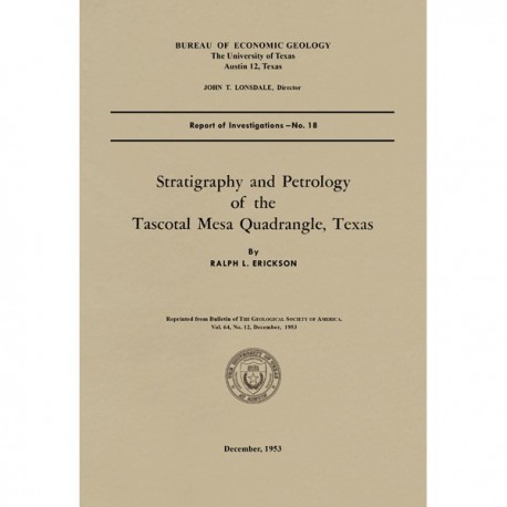
Stratigraphy and Petrology of the Tascotal Mesa Quadrangle, Texas
RI0018
RI0018. Stratigraphy and Petrology of the Tascotal Mesa Quadrangle, Texas, by R. L. Erickson. 34 p., 4 figs., 1 map, 4 pls. Reprinted from Geological Society of America Bulletin, v. 64, no. 12, 1953. RI0018.
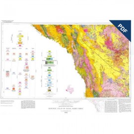
To purchase a copy of the geologic map only (scale 1:62,500, 1953), please order MM0031.
Excerpted from the Introduction
The Tascotal Mesa quadrangle is in southeastern Presidio and southwestern Brewster counties, Trans Pecos Texas. Bandera Mesa and Tascotal Mesa are reached most easily from Marfa, 50 miles north, by the Marfa-Lajitas road which traverses the quadrangle from north to south. Green Valley in the northeastern part of the area is most easily reached from Marfa by the 02 Ranch road in Paradise Valley; an alternate route is from Alpine by the Terlingua highway and the 02 Ranch road.
This investigation is primarily concerned with a thick succession of volcanic tuff and and related sediments with intercalated lava flows which Goldich and Elms (1949, p. 1143) named the Buck Hill volcanic series. Six months was spent in the field during the summer of 1949 and the spring of 1950. Mapping was done on aerial photographs and later transferred to the U.S. Geological Survey topographic quadrangle map (ed., 1944; surveyed in co-operation with the War Department).
Keywords: Brewster County, Presidio County, Texas, Tascotal Mesa quadrangle, Marfa area, Alpine area, tuff, lava, Buck Hill, maps
CONTENTS
Introduction
Location
Scope of work
Acknowledgments
Climate and vegetation
Topographic development
Pediments
Cretaceous system
General statement
Glen Rose limestone
Devils River limestone
Grayson clay
Buda limestone
Boquillas formation
Tertiary system
Buck Hill volcanic series
Pruett formation
Duff formation
Pruett-Duff beds
Mitchell Mesa tuff flow
Tascotal formation
Description
Lower tuff member
Basalt intercalation
Stratigraphic relations
Rawls basalt
Description
Basalt
Volcanic breccia
Trachyandesite porphyry
Tuff and breccia beds
Stratigraphic relations
Age and correlation
Quaternary system
Intrusive igneous rocks
Rhyolitic intrusives
Basaltic intrusives
Syenitic intrusives
Gabbro of La Mota dome
Chemistry and petrology
Extrusive rhyolitic rocks
Intrusive rhyolitic rocks
Extrusive basaltic rocks
Intrusive basaltic rocks
Intrusive syenitic rocks
Welded luff and breccia
Variation diagram
Structural geology
Regional setting
Northern part of quadrangle
Southern part of quadrangle
Summary geologic history
References cited
Figures
1. Index map of part of Trans-Pecos Texas
2. Diagrammatic cross section
3. Variation diagram of igneous rocks from the Tascotal Mesa quadrangle and adjacent areas
4. Structure of southern Trans-Pecos Texas
Plates
1. Geologic map and structure sections of the Tascotal Mesa quadrangle, Texas
2. Cretaceous formations
3. Boquillas formation
4. Duff formation
5. Tascotal formation and Rawls basalt
Tables
1. Geologic formations in the Tascotal Mesa quadrangle
2. Chemical analyses of rhyolitic rocks
3. Chemical analyses of Rawls flows
4. Chemical analyses of syenogabbro, microsyenite, and plagioclase syenite
5. Chemical analyses of indurated and partially fused tuff-breccia bed between flows of Rawls basalt
6. Chemical analyses of Tascotal Mesa rocks and norms of igneous rock
Citation
Erickson, R. L., 1953, Stratigraphy and Petrology of the Tascotal Mesa Quadrangle, Texas: The University of Texas at Austin, Bureau of Economic Geology, Report of Investigations No. 18, 34 p.
