UT Bulletins
-
Books & Reports
- Reports of Investigations
- Guidebooks
- Udden Series
- Geological Circulars
- Down To Earth
- Atlases of Major Oil and Gas Reservoirs
- Texas Memorial Museum Publications
- Environmental Geologic Atlas of the Texas Coastal Zone
- Mineral Resource Circulars
- Other Reports
- Seminars and Workshops
- Handbooks
- Submerged Lands of Texas
- Symposia
- Annual Reports
- Open File Reports
-
Maps & Cross Sections
- Thematic Maps
- Miscellaneous Maps, Charts & Sections
- Geologic Atlas of Texas
- STATEMAP Project Maps
- Geologic Quadrangle Maps
- Cross Sections
- Highway Geology Map
- Energy and Mineral Resource Maps
- Shoreline Change and Other Posters
- Wilcox Group, East Texas, Geological / Hydrological Folios
- Bouguer Gravity Atlas of Texas
- River Basin Regional Studies
- Featured Maps
- Posters
- Teachers & the Public
-
Geological Society Publications
- Gulf Coast Association of Geological Societies
- Alabama Geological Society
- Austin Geological Society
- Corpus Christi Geological Society
- Houston Geological Society
- Lafayette Geological Society
- Mississippi Geological Society
- New Orleans Geological Society
- South Texas Geological Society
- GCS SEPM Publications
- Historic BEG & UT Series


BL3027. The Geology of Stonewall County, Texas, by L. T. Patton. 77 p., 1 map, 1930.
CONTENTS
Introduction
Physiography
Physiographic relations of the county
Physiography of the county
Drainage
Relief
Physiographic history
Descriptive geology
Stratigraphy
Permian system
Clear Fork group
Double Mountain group
San Angelo formation
Blaine formation
Peacock formation
Triassic and Cretaceous systems
Tertiary and Quaternary systems
Structural geology
Rocks not exposed
Economic geology
FIGURES
Fig. 1. Outline map of Texas showing the location of Stonewall County
Fig. 2. Escarpment of the Blaine formation
Fig. 3. Distant view of the escarpment of the Swenson gypsum
Fig. 4. Generalized section of the rocks exposed at the surface in Stonewall County
PLATE
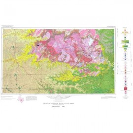
Plate 1. Geologic map and structure sections of Stonewall County, following page 78
Keywords: Blaine formation, Stonewall County, Texas
Citation
Patton, L. T., 1930, The Geology of Stonewall County: University of Texas, Austin, Bureau of Economic Geology, UT Bulletin 3027, 77 p.