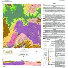
Oversize, color geologic maps on a topographic base, scale 1:24,000, depicting various geologic quadrangles in Texas, with informal text booklet, 1990's to the present
STATEMAP Project Maps
-

Sabine Pass and Texas Point quadrangles,... Sabine Pass and Texas Point quadrangles,...
$10.00Geoenvironmental Map of Sabine Pass and Texas Point Quadrangles, Texas Gulf of Mexico Coast, by T. A. Tremblay, W. A. White, and Tiffany Caudle. Oversize color geologic map on topographic map base, map scale 1:24,000, 2009. Digital Version.For a print version: OFM0186. Geoenvironmental Map of Sabine Pass...
 In Stock
 -

Sabine Pass and Texas Point quadrangles,... Sabine Pass and Texas Point quadrangles,...
$15.00Geoenvironmental Map of Sabine Pass and Texas Point Quadrangles, Texas Gulf of Mexico Coast, by T. A. Tremblay, W. A. White, and Tiffany Caudle. Oversize color geologic map on topographic map base, map scale 1:24,000, 2009. Paper map. Print Version.For a downloadable, digital version: OFM0186D. Geoenvironmental Map of Sabine Pass...
This map is currently printed on demand. Please allow a few extra days for processing. -

Geoenvironmental Map of Clam Lake... Geoenvironmental Map of Clam Lake...
$10.00Geoenvironmental Map of Clam Lake Quadrangle, Texas Gulf of Mexico Coast, by T. A. Tremblay, W. A. White, and Tiffany Caudle. Oversize color geologic map on topographic base, map scale 1:24,000, 2009. Digital Version.For a print version: OFM0185. Geoenvironmental Map of Clam Lake...
In Stock -

Geoenvironmental Map of Clam Lake... Geoenvironmental Map of Clam Lake...
$15.00Geoenvironmental Map of Clam Lake Quadrangle, Texas Gulf of Mexico Coast, by T. A. Tremblay, W. A. White, and Tiffany Caudle. Oversize geologic map on color topographic base, map scale 1:24,000, 2009. Paper map. Print Version.For a downloadable, digital version: OFM0185D. Geoenvironmental Map of Clam Lake...
This map is currently printed on demand. Please allow a few extra days for processing. -

Port Arthur South quadrangle, Texas.... Port Arthur South quadrangle, Texas....
$10.00Geoenvironmental Map of the Port Arthur South Quadrangle, Texas Gulf of Mexico Coast, by T. A. Tremblay, T. L. Caudle, and W. A. White. Oversize geologic map on color topographic base, map scale 1:24,000, with explanatory text, 2007. Digital Version.For a print version: OFM0184. Geoenvironmental Map of the Port...
In Stock -

Port Arthur South quadrangle, Texas Port Arthur South quadrangle, Texas
$15.00Geoenvironmental Map of the Port Arthur South Quadrangle, Texas Gulf of Mexico Coast, by T. A. Tremblay, T. L. Caudle, and W. A. White. Oversize geologic map on color topographic base, map scale 1:24,000, with explanatory text, 2007. Paper map. Print Version.For a downloadable, digital version: OFM0184D. Geoenvironmental Map of the Port...
In Stock -

Big Hill Bayou quadrangle, Texas. Digital... Big Hill Bayou quadrangle, Texas. Digital...
$10.00Geoenvironmental Map of Big Hill Bayou Quadrangle, Texas Gulf of Mexico Coast, by T. A. Tremblay, Tiffany Caudle, and W. A. White. Oversize color geologic map on topographic base, map scale 1:24,000, 2009. Digital Version.For a print version: OFM0183. Geoenvironmental Map of Big Hill...
In Stock -

Big Hill Bayou quadrangle, Texas Big Hill Bayou quadrangle, Texas
$15.00Geoenvironmental Map of Big Hill Bayou Quadrangle, Texas Gulf of Mexico Coast, by T. A. Tremblay, Tiffany Caudle, and W. A. White. Oversize geologic map on color topographic base, map scale 1:24,000, 2009. Print Version.For a downloadable, digital version: OFM0183D. Geoenvironmental Map of Big Hill...
This map is currently printed on demand. Please allow a few extra days for processing. -

Seymour Aquifer Deposits, Texas. Digital... Seymour Aquifer Deposits, Texas. Digital...
$10.00Geologic Map of the Seymour Aquifer Deposits, Vernon, Texas, 30 x 60 Minute Quadrangle, map scale 1:100,000, 2003. Digital Version.For a print version: OFM0182. Geologic Map of the Seymour Aquifer...
In Stock -

Seymour Aquifer Deposits, Texas Seymour Aquifer Deposits, Texas
$15.00Geologic Map of the Seymour Aquifer Deposits, Vernon, Texas, 30 x 60 Minute Quadrangle, by E. W. Collins. Oversize color geologic map, map scale 1:100,000, 2003. Print Version.For a downloadable, digital version: OFM0182D. Geologic Map of the Seymour Aquifer...
In Stock -

Tunis Quadrangle, Texas. Digital Download Tunis Quadrangle, Texas. Digital Download
$10.00Geologic Map of the Tunis Quadrangle, Texas, by E. W. Collins. Oversize geologic map on topographic base, map scale 1:24,000. Digital Version.For a print version: OFM0181. Geologic Map of the Tunis Quadrangle,...
In Stock -

Tunis Quadrangle, Texas Tunis Quadrangle, Texas
$15.00Geologic Map of the Tunis Quadrangle, Texas, by E. W. Collins. Oversize geologic map on color topographic base, map scale 1:24,000, with explanatory text, 2007. Print Version.For a downloadable, digital version: OFM0181D. Geologic Map of the Tunis Quadrangle,...
This map is currently printed on demand. Please allow a few extra days for processing.